
Holo Neom - HoloNeom.com
HoloNeom.com combines “Holo” (holographic, spatial, immersive technology) with “Neom” to create a bold, high-tech identity rooted in one of the world’s most ambitious future-city concepts. The name signals cutting-edge immersive experiences—perfect for positioning at the intersection of XR, smart infrastructure, tourism innovation, and digital twins.
The domain can anchor a full ecosystem:
-
holographic exhibitions and futuristic events
-
AR/VR city experiences and immersive tourism
-
AI-powered holographic assistants and digital guides
-
spatial computing for smart infrastructure
-
digital twin visualization platforms
-
immersive education and innovation labs
HoloNeom.com works especially well for tech studios, integrators, and event production companies serving advanced urban environments. It can also function as a media and insights hub covering immersive tech, smart city pilots, and next-gen digital experiences.
Short, visionary, and ecosystem-aligned, HoloNeom.com is built to become a standout identity for immersive innovation in next-generation urban environments—where spatial computing meets bold future ambition.

iHolo App - iHolo.App
iHolo.App combines the iconic “i” prefix (intelligent, interactive, individual, immersive) with “Holo” (holographic, hologram, holospace), creating a brand identity that feels modern, premium, and product-ready.
The “.app” extension reinforces its software-first positioning, clearly signaling a digital product built for mobile, AR/VR, and spatial computing environments.
iHolo.App naturally aligns with high-growth sectors such as:
-
augmented reality (AR) applications
-
virtual reality (VR) experiences
-
holographic communication platforms
-
spatial collaboration tools
-
immersive education solutions
-
3D projection and telepresence apps
-
mixed reality entertainment platforms
-
AI-driven holographic assistants
The name feels like:
-
a consumer tech product
-
a Silicon Valley-style startup
-
an Apple-ecosystem-compatible app
-
a metaverse-ready platform
-
a next-gen communication tool
iHolo.App can serve as:
-
a holographic video calling platform
-
an AR-based retail visualization tool
-
a hologram avatar AI assistant
-
a 3D event and exhibition platform
-
an immersive learning and STEM education app
-
a mixed reality gaming experience
The combination of “i” and “Holo” creates a clean, memorable, and scalable brand that works globally. It suggests personalization and intelligence layered over immersive technology.
Short, futuristic, and highly brandable, iHolo.App is built for the era of spatial computing and holographic interaction—where reality becomes interactive.
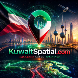
Kuwait Spatial - KuwaitSpatial.com
KuwaitSpatial.com combines “Kuwait,” representing one of the Gulf’s established and infrastructure-driven markets, with “Spatial,” a powerful technology term associated with geographic data, location intelligence, mapping, GIS, urban planning, and spatial analytics.
The result is a clear, professional, and highly specialized domain that conveys location-based intelligence, digital mapping, and smart infrastructure insight, making it ideal for platforms focused on GIS systems, geospatial analytics, smart cities, real estate intelligence, logistics optimization, and public-sector planning in Kuwait.
The word “Kuwait” brings:
- strong geographic relevance and local market clarity
- immediate recognition for government entities, enterprises, developers, and investors
- strong fit for infrastructure, real estate, public services, and smart city initiatives
- scalability across public-sector, private-sector, and B2B technology use cases
The word “Spatial” brings:
- strong association with maps, geography, land, infrastructure, and location data
- relevance to GIS platforms, urban planning, mobility, utilities, and asset management
- technical credibility for data-driven government and enterprise solutions
- flexibility across analytics, dashboards, APIs, mapping tools, and digital twins
When combined, “KuwaitSpatial” creates a powerful identity that connects Kuwait’s physical landscape with digital intelligence, planning, and geospatial technology.
The concept of “KuwaitSpatial” positions itself as a platform where governments, businesses, planners, and developers can:
- access location intelligence and spatial data
- visualize maps, land parcels, infrastructure, and assets
- analyze real estate, mobility, utilities, and urban development trends
- support smarter planning, investment, and decision-making
- build digital maps, dashboards, and geospatial applications
This ecosystem may include:
- GIS and mapping platforms
- location intelligence dashboards
- smart city and urban planning systems
- real estate and land analytics tools
- infrastructure and utilities mapping platforms
- logistics and route optimization solutions
- environmental and climate mapping systems
- public-sector geospatial data portals
- construction and development planning tools
- AI-powered spatial analytics and prediction engines
KuwaitSpatial.com naturally positions itself as a flagship brand for geospatial intelligence, GIS platforms, and smart location-based solutions in Kuwait.
Potential platform directions
KuwaitSpatial.com can support several strategic directions:
- a GIS and mapping platform for Kuwait
- a location intelligence and spatial analytics dashboard
- a smart city planning and digital twin platform
- a real estate and land data intelligence portal
- an infrastructure and utilities mapping system
- a logistics and mobility optimization platform
- an environmental and climate mapping tool
- an AI-powered geospatial analytics platform
Industries where the domain fits well
The domain works particularly well in sectors such as:
- GIS and geospatial technology
- smart cities and urban planning
- real estate and land development
- infrastructure and utilities
- government digital transformation
- logistics and mobility
- construction and engineering
- environmental monitoring
- telecom and network planning
- AI-powered location intelligence
Brand message and positioning
KuwaitSpatial.com communicates:
- location intelligence and geospatial clarity for Kuwait
- strong relevance to smart cities, planning, infrastructure, and real estate
- technical credibility with public-sector and enterprise appeal
- scalability across GIS, digital twins, dashboards, APIs, and AI analytics
- value for governments, developers, utilities, logistics providers, investors, and planners
- a powerful digital identity for Kuwait’s spatial data and smart infrastructure ecosystem
Technical, focused, and highly scalable, KuwaitSpatial.com has the potential to become a leading brand for GIS platforms, location intelligence, smart city mapping, real estate analytics, and geospatial data solutions in Kuwait.